
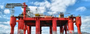
How Map Based and Web Based Applications Can Advance Your Oil and Gas Operations
It’s not news that the oil and gas industry is facing challenges. With strict regulations on the oil and gas industry, the increase in global demand, insufficient resources, restricted exploration environment, and decreasing profit margins, it is crucial for companies within the industry to implement smarter work processes using Geospatial technology in order to stay afloat.
Leading oil and gas companies have already taken the step forward back in 2010 at GIS in Oil and Gas 2010 conference in Abu Dhabi Dubai, where industry challenges were identified and exploration on how GIS can enhance planning and operations took place.
The data used in the Oil and Gas industry to carry out tasks such as oil exploration, environmental studies, and pipeline construction are spatial in nature. The Oil and Gas industry is heavily connected to geography and would benefit from up to date modern Geographic Information System (GIS) the most.
Asset Tracking
In oil and gas, geodatabases collect and visualize physical locations of assets such as pipelines, wells, pump stations, and tank terminals. Being able to identify and track the exact location of assets is undoubtably beneficial. The spatial data within GIS that allows asset tracking can also contain non spatial data such as installation dates, pipe materials and so forth.
Environmental Monitoring
It is essential for oil and gas companies to comprehensively monitor environmental changes related to operation. With satellite interferometric synthetic aperture radar (InSAR), continual monitoring of large areas via automated change detection with satellites is achievable. This enables quick responses to emergencies such as oil leaks, gas explosions, as the monitoring of environments is accessible from any platform in any location (e.g. cellphone devices with on ground workers, laptops, or tablets in corporate offices).
Well Planning and Pipeline Routing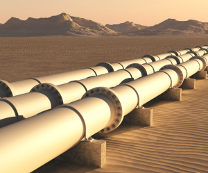
When it comes to planning well drilling patterns and pipeline routing, GIS significantly facilitates the decision making process and optimizes results. For pipeline routing, Geospatial technologies have simplified the process of analyzing and identifying a route with the lowest level of resistance between a source point and a destination. Studies show that this geospatial analysis has reduced costs by up to 15%. Similarly, well drilling patterns are optimized to provide the most efficient drilling configuration using spatial data from GIS.
Future Benefits of Spatial Applications for the Oil&Gas Industry
Geospatial technology in Oil and Gas is constantly innovating and breaking barriers that result in time and cost efficient solutions for the future. A Geographic Information System that can be updated to accommodate future solutions and features is an important consideration when looking to invest in one. Currently, the advancement of GIS for the oil and gas industry is looking incredibly beneficial.
Pipeline Monitoring
A rising use of Geospatial application for pipeline monitoring is the integration of digital video on a map. These videos allows for engineers to see sections of pipelines and monitor installation hazards. Although not widely used today, the integration of digital videos within GIS will be common once the Oil and Gas industry realizes its benefits as it increases accuracy in decision making and analytic processes.
Field Operations
Another futuristic Geospatial technology on the rise, is field operation monitoring using UAV sensor technology to obtain imagery of a field location to virtually inspect work site progress. This new integration into GIS will be extremely beneficial as it will enable management of on-site projects to be done virtually, enabling managers to oversee multiple projects at a time. This results in more work being done in less time and saves on logistic expenses.
Artificial Intelligence
Artificial intelligence, now commonly used in various industries, has become a topic of conversation to combine with Geospatial intelligence. A few software development companies, such as i-Open Technologies, have already started to integrate AI in GIS. This combination enables accurate geospatial analysis at a faster rate, resulting in faster decision making processes, accurate and timely emergency responses and solutions. However, the integration of AI is built on data collection, validation, and enrichment from historical data systems.
“While many GIS users are content with the cartographic paradigm of ‘drawing a map’ to answer a question, many human systems require spatial reasoning to happen in an autonomous manner, require advanced spatial analysis methods capable of making judgments based on data or knowledge, or simply require analysis methods outside the traditional GIS toolbox. Decision support systems, built to help humans make informed decisions, are classic examples of where GIS can be effectively coupled with reasoning techniques developed in the AI community” explained Voženílek , VP of the International Cartographic Association.
Most oil and gas companies have taken the steps to integrate Geospatial technology within their operational decision making processes, and your company may be looking to do the same. Taking small steps in implementing Geospatial applications can start your journey to building a foundation for future tools. Time waits for no one, take innovative steps now or your company may be at risk of falling behind.
If you have any questions or enquiries regarding the relation between GIS and the Oil and Gas Industry, send us a message or visit oilandgasoperations.ca and we’ll be more than happy to answer any questions you may have.