
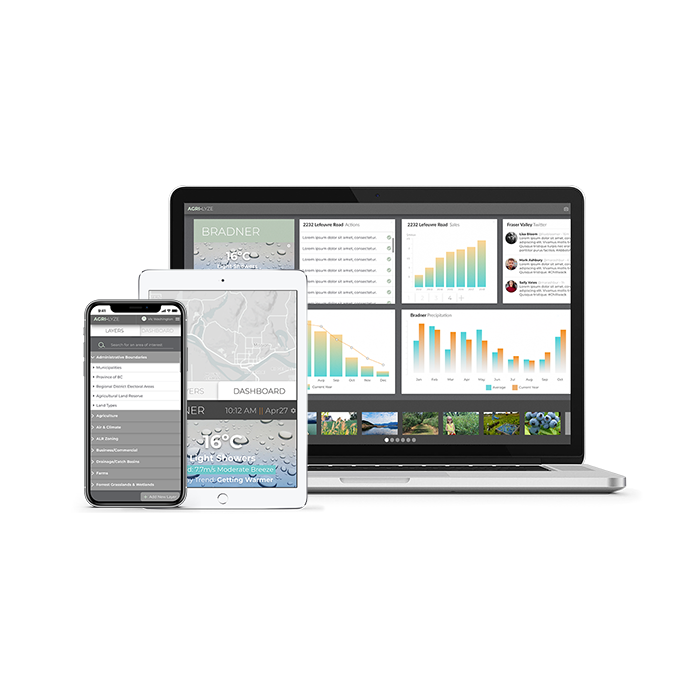

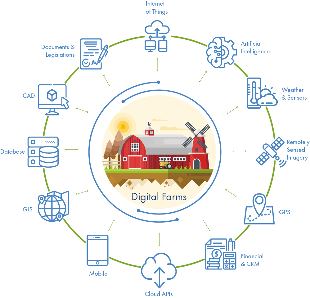
Premium data aggregated in one easy to use platform enabling precision agriculture by combining leading-edge technologies such as Ai and IoT.
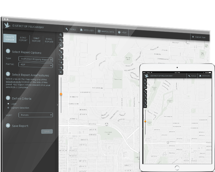
A complete enterprise web-mapping and fully managed data maintenance solution that meets local government needs.
Agrilyze Develops Soil Testing Device in Partnership with Simon Fraser University
Enabling access to premium localized data, industrial-strength GIS, and day-to-day management tools, Agrilyze is an advanced and powerful platform to aid users to operate at high efficiency with optimum accuracy.
Watch the video of our latest soil testing device in action.
From data to decision making to operational integrity, planworX is an advanced and powerful data maintenance, asset tracking, and project tracking solution.

Product Specifications
Capabilities
Key Drives
• Simple to use and maintain
• Specifically designed to maintain and manage your infrastructure
• Designed around industry standard tools such as ESRI
Key Features
Key Features
• Web-based application that is simple to use and maintain
• Wide selection of basemaps from ESRI
• Advanced reporting capabilities
Digital Agriculture

Accurate Decision Making
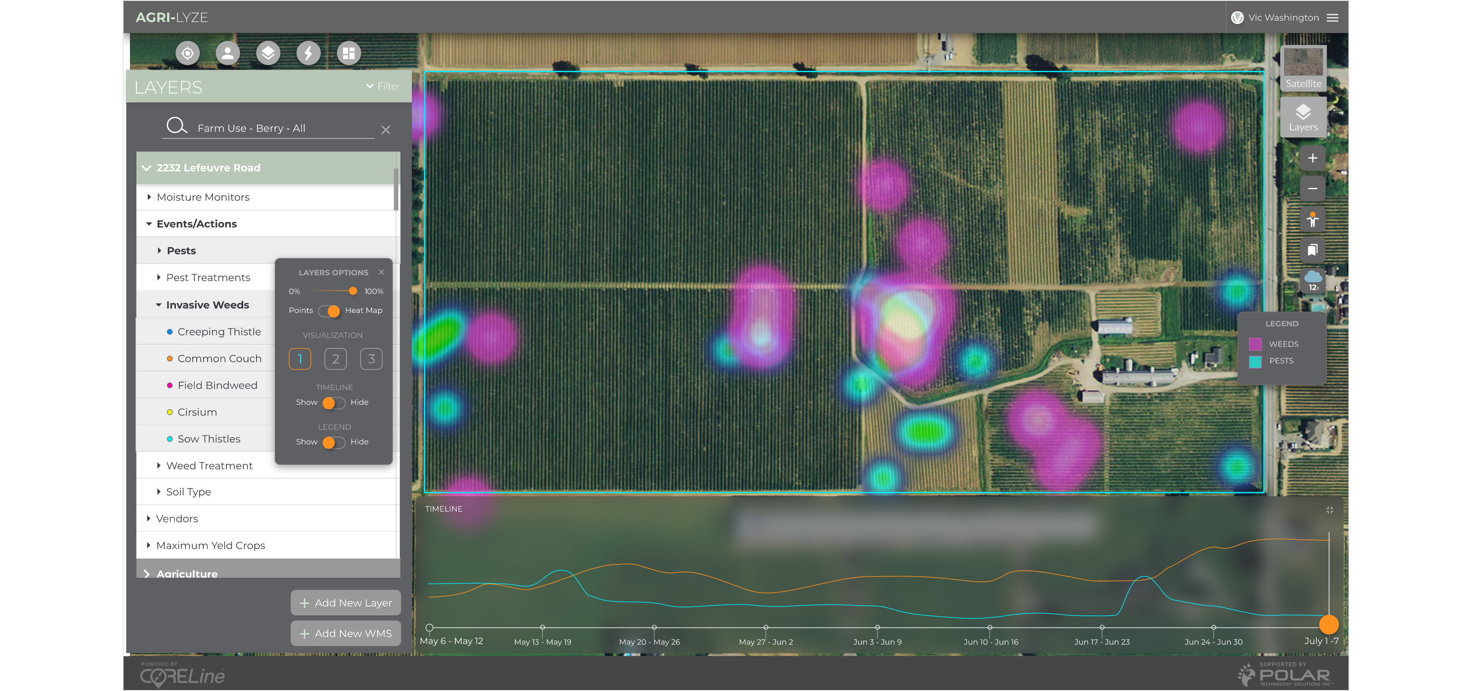
Agrilyze gathers and provides industry data analytics in a centralized interface. Users get easy access to premium geospatial data for accurate decision making.
Powered by Ai
Leverage artificial intelligence and predictive analysis for

Anywhere, Anytime, Any Device
Agrilyze is a cloud-hosted platform so you can access local agriculture industry data from any device in any location.
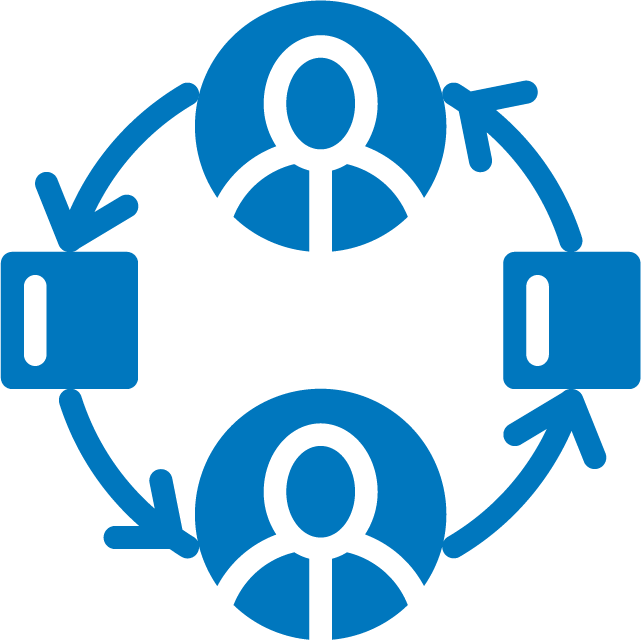
Task Management
Increase efficiency through Agrilyze’s workflow management tool. Assign tasks and monitor what is getting done through a shared interface.
End to End Data Analytics for Precision Agriculture
Digital Agriculture Transformation
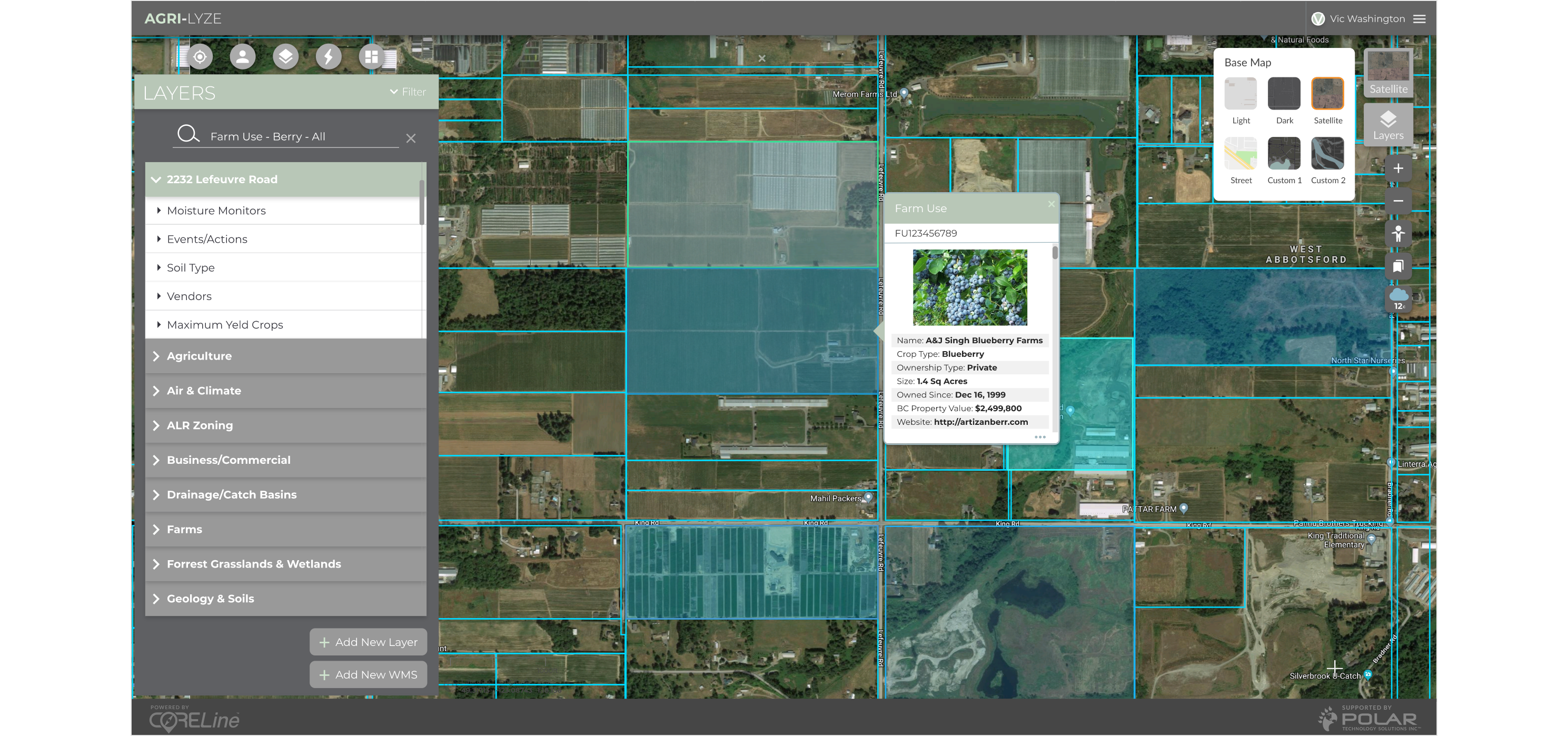
To be successful, an agricultural operation must grow as much as possible based on the size of the facility and prevent crop failure while minimizing the impact of unpredictable conditions. Indeed, most of the data are already available in various forms and tools. However, Agrilyze is best positioned to deliver public and private local data sources in a tailored format for each operation unique to a given facility for day to day work management requirements. Through a single integrated and seamless interface enabling increased operational efficiency and mitigating losses, Agrilyze provides incomparable value and advantage to all users.
How it Works
Addressing Industry Challenges by Integrating Technology in Agriculture Processes.
Leveraging multiple leading-edge innovations such as Al, satellite imagery, change and image detection technologies in combination with multiple sets of private and public data, Agrilyze delivers local industry with the first centralized agriculture data portal. Utilized by local farmers, educational institutions, companies, and governments, Agrilyze enables predictive data analysis and visualization to rapidly discover sources and planning patterns for delivery of precision agriculture.